Overview
ArcticDEM is an NGA-NSF public-private initiative to produce a high-resolution, high quality, digital surface model (DSM) of the Arctic using optical stereo imagery, high-performance computing, and open source photogrammetry software.
Upon completion, ArcticDEM will encompass all land area north of 60° north latitude including all of Greenland, the State of Alaska, and the Kamchatka Peninsula of the Russian Federation. The project data releases began with Alaska on September 1, 2016, and will continue to other regions in the Arctic on a quarterly basis.
Release 2: Updates
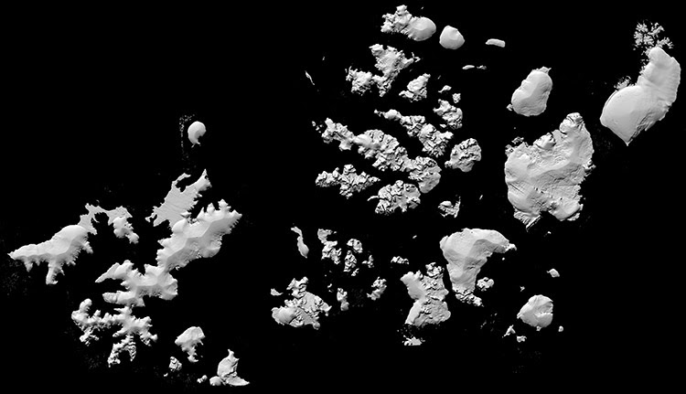
The Russian regions of Novaya Zemlya and Franz Josef Land are now available for download. Release 2 has added 1,124 strip DEM components at 2-meter resolution and 96 tile DEM components at 5-meter resolution to the ArcticDEM inventory.
The launch of ArcticDEM Release 2 coincides with the first-ever Arctic Science Ministerial, held at the White House on September 28th, 2016, where Science Ministers from 25 governments and the European Union assembled for a discussion of Arctic affairs.
The ESRI ArcticDEM viewer has been extended to include more than 54,000 time-dependent 8-meter posting elevation strips covering a total of more than 17,000,000 square kilometers. In addition, 6,500 2-meter posting DEM strips and 5-meter mosaics are available for display and download through the viewer. Please note the 8-meter data is preliminary and not available for download at this time. As the 2-meter data is produced, the 8-meter strips will be replaced and the 2-meter data will be available for download.
Release 2: Press
White House: US Hosts First-Ever Arctic Science Ministerial
Science: A view of the Arctic in high relief
EOS: First Arctic Science Ministers’ Confab Yields Cooperation Pledge
Paul’s favorite article: Scientists finally made half-way decent map of Alaska
Explore Data
ArcticDEM data are available for online browsing and download. Visit ArcticDEM.org to connect to the ArcticDEM Explorer or to download bulk data.
