
Missed out on the newsletter via email? Sign up here!
NEW! ArcticDEM Viewer in Google Earth Engine Apps
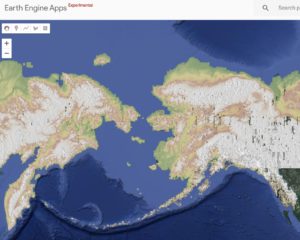
The apps are dynamic, shareable user interfaces for Earth Engine analyses and
are very accessible for experts and non-experts to use.
Code: https://code.
Upcoming PGC Users Webinar
We know the Antarctic field season just ended but it’s already time to start planning for 2020-2021.
This webinar is open to all United States Antarctic Program (USAP) grantees, logistics and operations contractors
planning on deploying to the ice next season. Learn about data and services available for USAP projects:
pre-deployment as well as on-ice (we staff an office in McMurdo).
The webinar will include an interactive Q&A session with PGC staff.
Registration is open to USAP participants only and subject to approval.
(USAP event number or NSF/NASA award number required)
WHAT: Geospatial Data for Planning Antarctic Field Seasons
WHEN: March 25, 2020 at 12-12:30 PM Central
WHO: USAP Participants deploying in 2020-21 (Grantees and Contractors)
REGISTRATION: https://umn.
Webinar materials are available on our website within the About > Impact page under ‘Education & Outreach.’
Antarctic On-Ice Support Recap
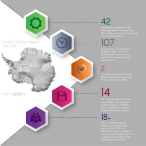
Thank you to our Users for your understanding and cooperation of our minor schedule changes.
We are pleased to continually provide science and logistics support from McMurdo Station each austral summer, even if that means sporting some sunglass suntan lines after a couple months in 24 hour sunlight.
Already looking forward to the next season!
PGC Website Guides

The PGC provides a suite of instructional and informative materials covering a diverse range in topics including our most recently added section: ‘Coding and Utilities.’
Interested in batch image orthorectification or pansharpening? Or are you working with an overabundance of ArcticDEM or REMA data and need to index, shelve, copy or modify the data? Walk through the ‘Coding and Utilities’ guides to learn how to utilize our suite of tools and scripts to automate processes.
Additional guide sections include User Services, Commercial Imagery, Stereo Elevation Models, ArcticDEM, Web Mapping Applications, and more!
Annual PGC User Survey Coming April 1 – 30
![]()
We value our users and your feedback guides our focus and prioritizes improvements that will be most impactful.
Please consider participating in our third annual User Survey launching April 1st through April 30th.
Subscribers to this newsletter will receive a survey invitation directly. Others not subscribed will be able to access the survey on our website.
PGC Education & Outreach
The PGC team is relatively small (less than 20!) but we continuously try to reach our users and the polar community in different ways.
Here is a snapshot of our education and outreach initiatives as of late. However, given the public health climate, we will temporarily
direct all of our E&O efforts to cyberspace – reaching users via newsletters, webinars, our website, social media, etc.
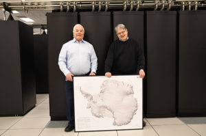
PGC Director, Paul Morin, and the NCSA Blue Waters’ Project Director, Bill Kramer touring the Blue Waters supercomputer, where ArcticDEM, REMA and EarthDEM are built.
Wondering how much compute power it takes to produce high resolution topography for the world? Check out the video clip of Morin walking the length of Blue Waters.
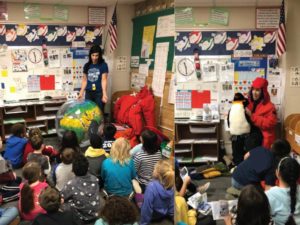
PGC’s Cathleen Torres Parisian visited a local elementary school to read about Matthew Henson for Black History Month, the first person to reach the North Pole, and to teach them about today’s polar explorers that come from all backgrounds.
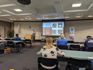
PGC’s Cole Kelleher presenting on increasing high-resolution data coverage and new possibilities in the polar regions at the ARCUS Polar Technology Conference in Boulder, CO.
Read the original PGC Newsletter post here.


