
Commercial Imagery
High resolution satellite imagery from Maxar available to PGC users at no additional cost to their award.
Earth from Space
Maxar, a U.S.-based space technology company, acquired the American commercial satellite imagery vendor DigitalGlobe in 2017. The constellation of satellites have been collecting imagery of the world in amazing detail.
With resolutions (pixel size) less than 1 meter, the satellite imagery can capture detail such as trees, chimneys, or … penguins.
Sensors
The Maxar constellation of satellites includes WorldView-1, WorldView-2, WorldView-3, WorldView-4 (excluded from NextView license) QuickBird, GeoEye, and IKONOS.
Capabilities
Sub-meter resolution, multispectral bands, and frequent revisit for collection of up to one billion km2 per year.
Archive
Millions of individual scenes globally along with repeat coverage many times over.
Collection
Continuous collection of the globe and the ability to task new collection.
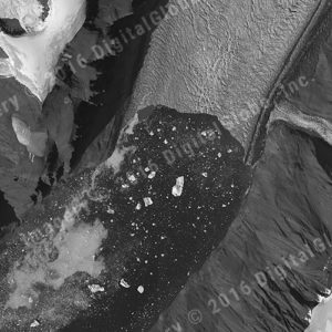
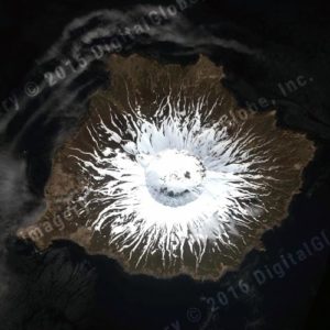
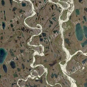
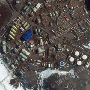
Examples
Example images from the polar regions from Maxar sensors.
WORLDVEW-1 (Panchromatic)
WORLDVIEW-2 (MULTISPECTRAL)
wORLDVIEW-3 (MULTISPECTRAL)
WORLDVIEW-2 (MULTISPECTRAL)
Imagery Access
PGC users have access to our archive of Maxar imagery for the polar regions including the Arctic and Antarctica.
Eligibility Options
Active research award from NSF Office of Polar Programs
U.S. Government contractor supporting NSF polar research
U.S. Government agency supporting NSF polar research